

By Joe Rantino, 14/06/2026
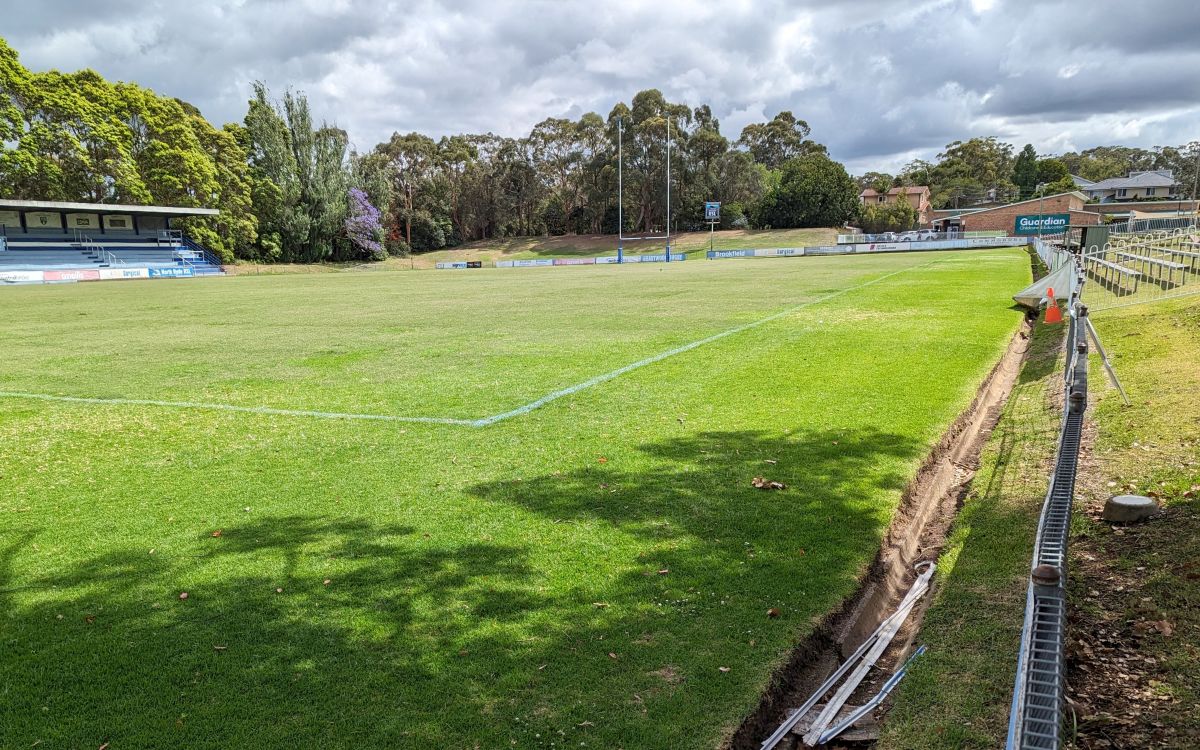
TG Millner Field. Image by Poyt448 Peter Woodard, CC0, via Wikimedia Commons

Few development proposals in Sydney’s north-west have sparked as much debate recently as the planned redevelopment of TG Millner Fields in Ryde.
Known as the Marsfield Common proposal, the project would transform the long-standing sporting precinct into a residential community featuring approximately 132 homes, public open space, landscaped areas and new infrastructure.
While supporters point to new housing and community benefits, many residents have raised concerns about the potential impacts on traffic, green space and flooding.
For homeowners, flood risk is more than a planning issue.
It can affect property values, increase insurance costs, compromise community safety and damage peace of mind.
With extreme rainfall events becoming increasingly common across New South Wales, understanding how a major redevelopment could influence stormwater flows and drainage has become a crucial part of the conversation.
So what does the available evidence say about flooding at TG Millner Fields, and how is the proposed development planning to manage those risks?
What is the TG Millner Fields Development Proposal?
The proposal involves the redevelopment of the TG Millner Fields site at 146/150 Vimiera Road, Marsfield – historically home to Eastwood Rugby Club and associated sporting facilities.
The proposal includes a new internal road network, detached and attached dwellings, approximately 10,000 square metres of public open space, and the planting of over 500 trees throughout the site.
The existing drainage easement in the north-west corner of the property would also be retained as part of the development plans.
As with any significant redevelopment, the proposal has required detailed assessment of local drainage, stormwater management and flood behaviour.
How does development impact flood risks?
Generally, one of the most common concerns surrounding urban development is the effect it can have on stormwater runoff.
Natural landscapes soak up rainwater through the soil.
When land is developed, hard surfaces replace soil. Roads, roofs, driveways, and paved areas can increase the amount of water that flows into drainage systems during heavy rainfall.
Without effective stormwater infrastructure, this can contribute to:
- Increased runoff
- Faster water movement across a site
- Additional pressure on existing drainage networks
- Localised flooding during severe storms
- Greater downstream flood impacts
However, modern developments are required to demonstrate that flood and drainage risks can be appropriately managed.
This often involves detailed planning and modelling, carefully designed detention systems, water-sensitive urban design measures, and upgraded stormwater infrastructure.
Understanding the existing flood risk in the area
According to the Northrop Stormwater Servicing Report prepared for this project, flooding on the site is primarily associated with flows originating from the Yangalla Street catchment to the north.
The report notes that while drainage infrastructure already exists in Yangalla Street, modelling indicates the current system does not have sufficient capacity during larger storm events.
When this occurs, water overtops the drainage network and moves through nearby properties before flowing into the TG Millner Fields site.
Importantly, the report states that this overland flow path is an existing feature of the local drainage system and will continue to require accommodation regardless of future development.
Council flood mapping identifies areas of both low and medium flood risk across portions of the site, particularly in the northern and western sections.
Key elements of the flood mitigation strategy
To address these challenges, the development proposal includes several flood and stormwater management measures designed to manage both on-site runoff and existing upstream flows.
Retention of existing drainage easements
The current drainage easement in the north-west corner of the site would be retained, allowing stormwater from upstream catchments to continue flowing through the area.
A dedicated drainage channel
One of the most significant proposed measures is the construction of a trapezoidal grassed drainage channel designed to capture and direct stormwater flows entering the site from the Yangalla Street catchment.
According to the engineers, alternative options such as piping all flows directly from Yangalla Street were investigated but considered impractical due to site topography and engineering constraints.
On-site detention tank
A large underground on-site detention (OSD) tank is planned for beneath the western open space area, temporarily storing stormwater during major rainfall events before releasing it at a controlled rate.
Water-sensitive urban design features
Measures including rainwater harvesting systems, a bioretention basin, a gross pollutant trap and water-quality treatment infrastructure have been designed to improve stormwater outcomes while integrating with landscaped public spaces.
Why flood-awareness matters for every property owner
While the future of TG Millner Fields continues to be assessed through the planning process, the debate highlights an important lesson for all homeowners.
Flooding is not always caused by rivers overflowing their banks. In many suburban areas, stormwater systems, blocked drains, ageing infrastructure and intense rainfall can create significant localised flooding even outside traditional flood zones.
Understanding how water moves across your property can help identify risks before they become costly problems.
Concerned about drainage performance, stormwater management or flood risks on your property?
Contact our team today to ensure your property is prepared for whatever the weather brings.